
April showers bring May flowers, right?
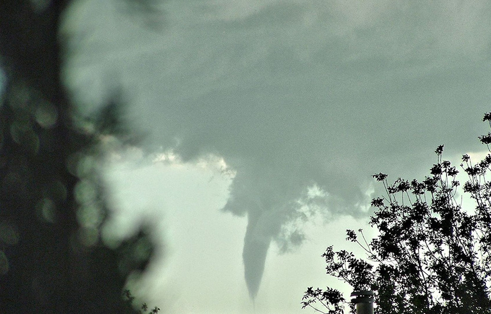
Spring has sprung, which means severe weather season is here. Fayetteville is located in what many meteorologists consider “Tornado Alley,” meaning the swath of the United States that experiences tornadoes most frequently when compared to the rest of the country.
While Fayetteville is located on top of a hill and majority of storms weaken as they approach our campus, it is still imperative that you be prepared in the event that extreme weather moves into the area.
Tornadoes happen. The last tornado siren warning was activated for the University of Arkansas campus at 9:14pm on March 6, 2017.
National Weather Service
Typically if there is an enhanced risk of severe weather brewing, the National Weather Service Storm Prediction Center will closely monitor the potential event and distribute information on their website and their Twitter (@NWSSPC).
Predictions get more certain as the potential event gets closer and probabilities of tornadoes, hail and damaging storms are predicted based off of these observations.
Words to remember:
1. Warning: There is an active and immediate threat for dangerous weather, both observed via radar technology or confirmed visually.
2. Watch: Conditions are favorable for severe weather to form. This does NOT mean that there is any immediate danger.
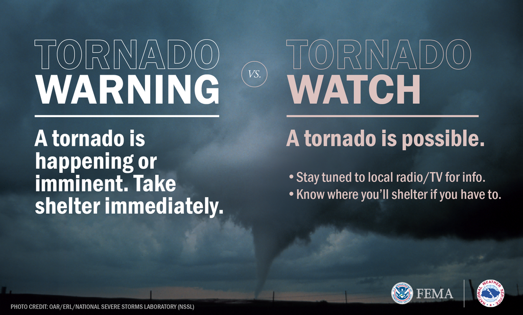
Photo by Federal Emergency Management Agency (FEMA) Graphic – Mar 09, 2016
On the day of the event, if the National Weather Service feels there is a heightened enough risk that conditions are present for high probability of severe weather, they will issue watches for the areas at highest risk.
If the National Weather Service issues a watch for Washington County, this means that everyone in the area should be as weather aware as possible and to alter plans if needed in order to keep themselves safe in the event that severe weather strikes.
If a tornado is indicated via radar or is confirmed visually by a certified storm spotter, the National Weather Service will issue a tornado warning for those in the path of the storm.
Warnings are issued by county but do not always include the entirety of a county if it is not in the path of the storm.
University of Arkansas Severe Weather Alert
In the event that any portion of Washington County is put under a tornado warning, the university’s RazALERT system will activate and notify the campus community of the incoming danger.
Once the threat of the storm has passed, RazALERT will NOT issue a retraction message, so this reinforces the need to be weather aware.
The campus sirens will not go off unless campus is in the direct path of the storm and included in the warning area.
When reporting to these areas, you should close all doors between you and outside. You should put on closed-toe shoes and take your keys, phone (and charger), and identification with you in the event that you are unable to get back to your room right away. Once the storm has passed, proceed with caution back to your room.
If you are in an area that is under a tornado warning, you should report immediately to your tornado shelter. If you are in the residence halls, the tornado shelters are indicated by signage in common areas throughout the building. Please note that many of our buildings do not have basements, but rest assured that you are safe in the designated shelter areas within the building.
Update Your RazALERT
In order to receive the most up to date information, all students are encouraged to subscribe to the RazALERT system to receive text, call and email updates about the happenings around campus.
All students are automatically subscribed via email, but are encouraged to subscribe to calls and/or text alerts by visiting the Campus Safety website.


Recent Comments